Welcome to Rio de Janeiro
Walking through Rio de Janeiro
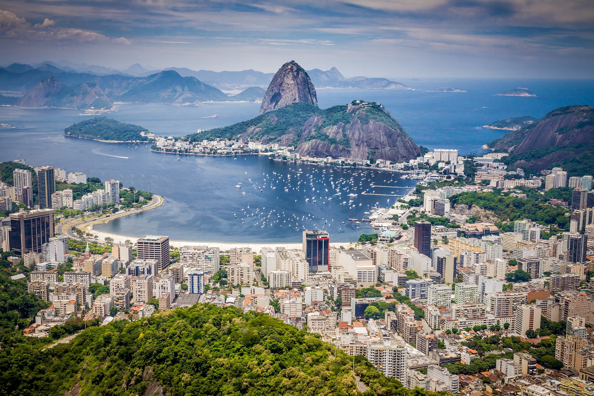
Every year, millions of visitors arrive in Rio de Janeiro with the same itinerary. They walk the Copacabana promenade, photograph the Christ statue, drink a caipirinha in Ipanema, and consider the city conquered. What they have actually seen is the Zona Sul — a narrow coastal strip with the beaches, the luxury hotels, and the postcard views. It is undeniably beautiful. It is also a stage set. The rest of Rio exists in a parallel geography. The northern, western, and southwestern zones contain commercial avenues, residential districts that range from working-class density to upper-middle-class comfort, and a street-level social life that the tourist strips have lost. The people who live there do not view their neighborhoods as exotic. They view them as home, and they have built an urban infrastructure that supports daily life without catering to foreign visitors. Walking through these districts means encountering a city that has no interest in your review, your Instagram post, or your travel blog. It is simply the city of Rio.
How the city is actually divided
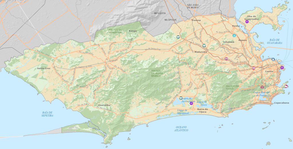
Understanding Rio requires abandoning the tourist map. The city is organized into zones. The Zona Sul is the smallest: a coastal pocket with the wealthy and nearly all hotels. North lies the Zona Norte, enormous, with access to Guanabara Bay but without a touristic coastline, containing every income level. Southwest, Barra da Tijuca and Recreio form the Zona Sudeste — an affluent coastal zone with modern towers, residential areas, shopping malls and gated communities. Further inland, the Zona Oeste is a vast territory, containing a full cross-section of Rio society. There is no Zona Leste; east of the center lies the sea. The Zona Sul is the anomaly: small, expensive, heavily policed for tourism. The rest is where Rio actually lives.
The Zona Norte on foot
The Zona Norte is Rio’s most populous zone and its most socially varied. Neighborhoods such as Tijuca, Vila Isabel, Andaraí, Méier, Irajá, Madureira or Todos os Santos rarely appear in English-language travel literature, yet each contains commercial corridors that function identically to the avenues visitors know from the south. Broad roads carry foot traffic past bakeries, pharmacies, clothing stores, and informal vendors selling fresh juice and snacks from carts. The visual texture is familiar — the same store formats, the same sidewalk patterns, often the same density of pedestrians — but the social purpose is different. These streets are built for residents, not for visitors. They are crowded at six in the evening with people returning from work, not at noon with tourists in swimwear.
Tijuca sits at the foot of the Tijuca National Forest, mixing dense residential blocks with patches of greenery. Vila Isabel, the birthplace of samba, invites slow, aimless walking. Its streets do not lead to a monument or a viewpoint. They simply continue, block after block, past houses with lace curtains and small gardens, past bars where regulars gather at the same hour every day. Méier and Todos os Santos serve as northern commercial hubs with multi-story galleries the boutique-oriented south cannot match. Andaraí is quieter, its tree-lined streets passing for a São Paulo neighborhood until the hills remind you that comunidades press against every part of this city. Some neighborhoods are solidly middle-class. Others are working-class. All are animated by a street energy the Zona Sul has surrendered to tourism. The absence of coastline does not mean an absence of public space. It means the social contract has shifted: people shop, commute, and socialize rather than performing leisure for an international audience.
Barra da Tijuca, Recreio, and the west
In the southwest, Barra da Tijuca and Recreio are a different alternative for a nice walk. They have beaches, but not the densely packed strips of Copacabana. The coastline is longer, backed by cute residential areas or modernist towers and gated communities. Walking in Barra means covering larger distances along landscaped shoulders. You will not find the density of the traditional beach strips. What you find instead is space, order, and a version of the city that feels more local than global. Fewer street vendors, fewer international tourists, and a stronger sense that the beach is a local amenity rather than a global stage. Recreio extends this pattern westward, where the shoreline quiets and the towers grow larger. Another walking option is the Peninsula region, a residential park that looks like a gated community but that anyone is allowed to enter for a walk.
Further inland, the Zona Oeste strips away the coastal gloss. The neighborhood of Bangu contains the Calçadão de Bangu, a busy commercial pedestrian corridor existing for decades. It looks nothing like the beach. No palm trees, no ocean breeze, no international brands. What exists instead is a dense retail street where locals buy household goods, electronics, and food, and where the sidewalk is contested territory. Municipal records document repeated cleanup operations: tons of unauthorized crates removed, vehicles ticketed, shopkeepers ordered to clear the walkways. The fact that enforcement is necessary tells you the street is actively used, and the competition for sidewalk space is intense enough to require intervention. The Calçadão does not need a tourist’s validation. That is what makes it worth walking. The Zona Oeste is Rio at its most ordinary. No famous monuments, no international nightlife. Only the texture of a megacity that expanded far beyond its original coastal settlement.
How to build a walking route
There is no established walking-tour industry in the northern and western zones, and that absence matters. Visitors construct their own itineraries. The method is straightforward: use a maps application to find the principal commercial street in a neighborhood, then walk that avenue and its perpendicular cross streets. In Rio, the greatest concentration of foot traffic and activity is always on these axes. The cross streets add residential texture without removing you from the safety of an active corridor. Start with a twenty-minute walk. If the neighborhood feels comfortable, extend it. If it does not, call a car and try another. There is no single route that defines Rio beyond the beach. There are dozens, and each one teaches you something the others do not.
The city administration maintains an official digital map through the data.rio portal. Search “mapa digital rio de janeiro” for reliable administrative boundaries and use your favorite street map apps for orientation. Clothing and utilities should be unremarkable: shorts, a T-shirt, sunglasses, a credit or debit card to get food and water. An older phone suffices for photographs and navigation; a flagship device sends the wrong signal to the wrong people. Install a rideshare app — Uber and 99 operate across the entire metro area — and link a card, since card payments are standard even in small bakeries. Cash is almost unnecessary; twenty reais covers the occasional vendor who does not accept electronic payment (in fact, you probably won’t need any cash at all). The single most effective security measure is to look like you belong. Those who target tourists to steal their phones know where they concentrate. They go to the beaches. A person walking through Méier or Bangu or anywhere else in casual dress does not fit the profile. If you walk around there, nobody cares about you.
Comunidades and the unwritten rules
No discussion of walking in Rio can avoid favelas, or comunidades, as the respectful local term goes. They are low-income settlements built without formal planning permission, existing in every zone, often directly adjacent to average or wealthy residential streets. The popular image of lawless zones bears little relation to reality. Approximately ninety-five percent of residents are ordinary working people. A small minority is involved in organized crime. Many comunidades are controlled by armed groups that do not seek confrontation with outsiders but enforce territorial boundaries with clarity.
The rule is absolute: do not enter a comunidade unless invited by a resident or accompanied by a local guide. In the tourist beach zones, a handful of favelas have controlled access points for tourism, which has relaxed the rule there. That exception does not apply to the northern and western zones. If you walk past the edge, nothing happens. If you step inside uninvited, someone will approach within meters and ask you to leave. The encounter is verbal and direct. Comply immediately. Police vehicles are stationed at the edges of many comunidades. If you notice ten or more police cars at a favela entry point, leave. Major police operations occur almost daily, but with several hundred comunidades in Rio, the chance of encountering one is low. Walking the commercial streets of the Zona Norte, Zona Oeste, or Barra is not urban exploration. It is what millions of Cariocas do every day.
Rio de Janeiro is a city that most visitors never actually see. They see the Zona Sul, which is real but incomplete, and leave thinking they have understood the place. Walking through northern avenues, western shopping streets, or the quieter coastal towers of the southwest corrects that. These districts do not need tourists to validate them. They function independently, with their own rhythms and social codes. The walker who leaves the beach circuit behind will find a Rio that is less photogenic, more complex, and more representative of how the city operates. The map is larger than the postcard. Most of it is on foot, and most of it is waiting for anyone willing to look past the shoreline and accept the city on its own terms.